Introduction
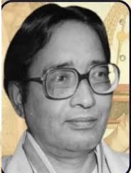
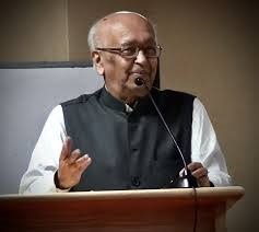
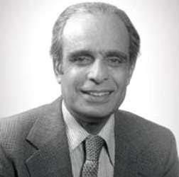
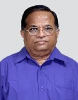
K. N. Shankara is a distinguished Indian space scientist, remote sensing expert, and scientific administrator known for his significant contributions to Earth observation, satellite remote sensing, geospatial technology, and natural resource management. He has played an important role in strengthening India’s Earth observation capabilities through the development and application of satellite technologies for agriculture, water resources, disaster management, forestry, and environmental monitoring. As the former Director of the National Remote Sensing Centre (NRSC) of the Indian Space Research Organisation (ISRO), Shankara has helped expand the use of satellite data for scientific research, governance, and sustainable development.
Early Life and Education
K. N. Shankara was born in India, though detailed information about his early life has not been widely published. From a young age, he displayed a keen interest in science, mathematics, and technology, particularly in understanding the Earth and its natural processes.
He pursued higher education in engineering and Earth sciences, specializing in fields related to remote sensing and geospatial technologies. His academic training provided expertise in:
- Remote Sensing
- Geospatial Information Systems (GIS)
- Satellite Data Processing
- Earth Observation
- Environmental Monitoring
- Space Applications
His strong technical background prepared him for a successful career in India’s space program.
Scientific Career & Research
Early Career at ISRO
K. N. Shankara joined the Indian Space Research Organisation (ISRO), where he worked on the development and application of satellite-based Earth observation systems. During his early career, he contributed to projects involving satellite imagery, digital mapping, and geospatial analysis.
His work supported national initiatives in agriculture, water management, and environmental conservation.
National Remote Sensing Centre (NRSC)
Shankara spent much of his career at the National Remote Sensing Centre (NRSC), Hyderabad, one of ISRO’s premier centers for Earth observation.
He served in several scientific and leadership roles before becoming Director of NRSC.
Under his leadership, NRSC strengthened its capabilities in:
- Satellite data reception and processing
- Remote sensing applications
- Geospatial services
- Disaster monitoring
- Natural resource assessment
- Digital mapping
Earth Observation Research
Shankara’s research has focused on the use of satellite technology to observe and understand Earth’s surface and environment.
His work includes:
- Land use and land cover mapping
- Forest monitoring
- Water resource assessment
- Urban planning
- Coastal zone management
- Environmental change detection
These applications have supported evidence-based decision-making for governments and researchers.
Disaster Management
One of his major contributions has been the use of satellite data for disaster management.
He helped develop systems for monitoring and assessing:
- Floods
- Cyclones
- Droughts
- Forest fires
- Landslides
- Coastal erosion
These systems provide timely information to disaster response agencies, improving preparedness and relief operations.
Natural Resource Management
Shankara has promoted the use of Earth observation data for sustainable management of natural resources.
His work has contributed to:
- Agricultural monitoring
- Crop forecasting
- Watershed management
- Groundwater assessment
- Soil resource mapping
- Biodiversity conservation
Geospatial Technology
He has been instrumental in advancing geospatial technologies in India by encouraging the integration of satellite imagery with GIS, GPS, and digital databases.
These technologies have been widely adopted in:
- Infrastructure planning
- Smart city development
- Rural development
- Environmental monitoring
- Public administration
Scientific Leadership
As Director of NRSC, K. N. Shankara guided several national programs involving:
- Earth observation satellites
- Satellite image processing
- Geospatial data infrastructure
- Disaster support systems
- National mapping initiatives
He also represented India in international collaborations on remote sensing and Earth observation.
Major Discoveries and Contributions
While Earth observation relies on collaborative technological development rather than individual inventions, K. N. Shankara has made several noteworthy contributions.
1. Strengthening India’s Earth Observation Program
He played a key role in enhancing the operational use of satellite data for monitoring the Earth’s environment and natural resources.
2. Advancing Remote Sensing Applications
Shankara promoted innovative applications of remote sensing in agriculture, forestry, hydrology, urban planning, and environmental protection.
3. Improving Disaster Monitoring
His leadership supported the development of satellite-based systems for rapid disaster assessment, enabling faster emergency response and damage evaluation.
4. Geospatial Information Systems
He contributed to integrating satellite imagery with GIS technologies, improving spatial analysis and decision-making across multiple sectors.
5. Resource Mapping
His work improved national capabilities in mapping land, water, forests, and mineral resources using high-resolution satellite data.
6. Promoting Space Applications for Development
Shankara emphasized the use of space technology to address societal challenges, including food security, water management, urbanization, and climate resilience.
Awards and Honours
K. N. Shankara has received several recognitions for his contributions to remote sensing, geospatial science, and space applications.
Some of his notable honours include:
- Recognition by the Indian Space Research Organisation (ISRO) for outstanding service.
- Leadership positions within national committees on remote sensing and geospatial technology.
- Fellowships and memberships in professional organizations related to geoinformatics and Earth sciences.
- Awards from scientific institutions for contributions to Earth observation and satellite applications.
- Invitations to serve on advisory panels and expert committees in the field of space technology.
Later Life and Career
After serving as Director of the National Remote Sensing Centre, K. N. Shankara continued contributing to the advancement of Earth observation and geospatial technologies.
His later activities have included:
- Advising government agencies on space applications.
- Promoting geospatial technologies for sustainable development.
- Delivering lectures and participating in scientific conferences.
- Supporting research collaborations in remote sensing and GIS.
- Mentoring young scientists and engineers.
As of the latest publicly available information, K. N. Shankara is living and remains associated with the advancement of space applications and Earth observation in India.
Legacy and Impact
Strengthening India’s Remote Sensing Capabilities
Shankara has played a significant role in expanding India’s capacity to acquire, process, and utilize satellite imagery for scientific and developmental purposes.
Advancing Disaster Management
His efforts have enhanced the use of satellite technology for disaster preparedness, emergency response, and post-disaster assessment.
Supporting Sustainable Development
Through applications in agriculture, water resources, forestry, and urban planning, his work has contributed to evidence-based resource management and environmental conservation.
Promoting Geospatial Technologies
He has encouraged the widespread adoption of GIS and remote sensing technologies across government, academia, and industry.
Scientific Leadership
As Director of NRSC, he strengthened one of India’s most important Earth observation institutions, fostering innovation and collaboration in geospatial sciences.
Inspiring Future Scientists
Through his leadership, mentorship, and commitment to technological innovation, Shankara has inspired a new generation of remote sensing specialists, geospatial analysts, and Earth observation scientists.
Conclusion
K. N. Shankara is a respected Indian scientist whose contributions to Earth observation, remote sensing, geospatial technology, and satellite applications have significantly strengthened India’s ability to monitor and manage its natural resources and environment. His leadership at the National Remote Sensing Centre (NRSC) has advanced the use of satellite data for disaster management, agriculture, urban planning, and environmental protection. Through his scientific expertise, administrative leadership, and dedication to applying space technology for societal benefit, Shankara has left a lasting legacy in India’s Earth observation and geospatial science programs.
About the Author